
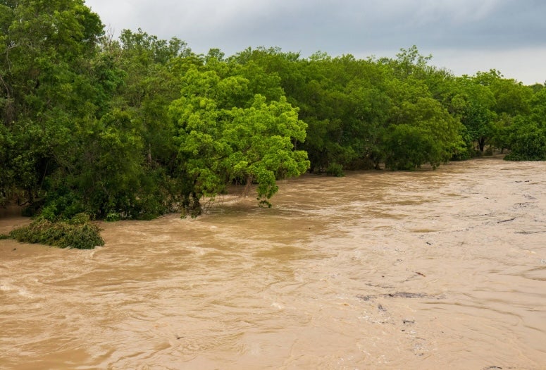
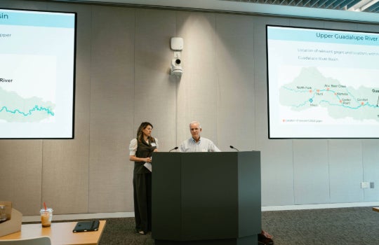
Rice University’s Severe Storm Prediction, Education and Evacuation from Disasters (SSPEED) Center convened researchers, emergency management officials, community stakeholders and industry partners Nov. 5 to advance development of a Flood Early Warning System (FEWS) for the Texas Hill Country, designed to give communities more time to respond to dangerous flooding.
The meeting, led by SSPEED Center director Philip Bedient, brought together representatives from Rice, the University of Texas at Arlington, Texas Tech University, U.S. Geological Survey, the city of Kerrville, the Upper Guadalupe River Authority, AT&T and other organizations to coordinate efforts spanning weather forecasting, flood modeling, emergency response and communications technology.
“My hope is that we leave here today not just with better science but with a clear path of turning that science into something that really saves lives,” said Kate Oshins, a Hill Country landowner whose family’s ranch along the Guadalupe River sustained extensive damage during the July 2025 flood.
Oshins described the destruction of roads, centuries-old trees and infrastructure on and around her property, along with the devastating human losses across the region. She urged the attendees to consider what residents need most when disaster strikes.
“Most landowners aren’t going to interpret complicated flood maps in the middle of the night,” Oshins said. “They want to know when the water’s coming, how quickly the road is going to be impassable … most importantly, how much time do I have?”
Those questions helped frame discussions about how to connect scientific capabilities with the realities of emergency response.
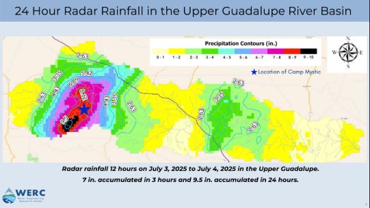
Funded in part by the Texas governor’s office, FEWS builds on technologies developed through flood prediction research conducted at Rice and UT Arlington and is being developed to integrate radar rainfall measurements, hydrologic modeling and an extensive floodplain map library that help anticipate where flooding may occur, how severe it could become and how quickly conditions could deteriorate. It will offer an easy-to-use interface, similar to how Google Maps helps users assess traffic conditions, building on earlier versions developed in the wake of Hurricane Harvey.
“We think we can get maybe one to three hours of lead time,” Bedient said, while emphasizing that the upper end of that estimate is ambitious. “Compared to approximately 30 minutes, which is about all the time you get up there in the Hill Country ... this is a big improvement.”
But forecasting is only part of the challenge.
Kerrville Fire Chief Eric Maloney, who helped lead the local response to the 2025 tragedy, described the extraordinary speed and force of the floodwaters and the difficulty of making critical decisions as conditions changed.
“How do we bridge the gap from the researchers in the room?” Maloney asked, emphasizing the importance of making scientific information accessible to emergency responders, both now and in the future.
That challenge is particularly significant in rural communities, where emergency management personnel often juggle multiple responsibilities with limited resources.
Tara Bushnoe, general manager at the Upper Guadalupe River Authority, stressed the importance of partnerships that strengthen local preparedness. She highlighted the developing Texas Institute of Hazard Risk and Readiness at Schreiner University as another resource for rural communities.
Matt Lepinski, assistant program director at UT Arlington’s Water Engineering Research Center (WERC), similarly emphasized that successful warning systems require ongoing collaboration, training and feedback between researchers and the people responsible for putting their technologies into practice.
Throughout the afternoon, participants examined how their individual efforts could contribute to a coordinated regional network.
WERC director Nick Fang, who is leading the development of FEWS in collaboration with Rice’s SSPEED Center, discussed the challenges of predicting flooding across the region’s steep canyons, complex soils and underground water systems, where intense, localized rainfall can produce rapidly changing conditions. Improving forecasts, he emphasized, requires integrating observations from multiple sources into models that emergency managers can rely on.
Texas Tech University atmospheric researchers John Schroeder and Brian Hirth outlined efforts to improve weather observations through 40 planned weather stations and three new radar systems, particularly in areas near watershed headwaters where existing coverage is limited. These measurements could help researchers identify intense rainfall earlier and provide more accurate inputs for flood prediction models.
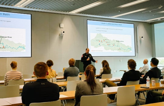
Other discussions addressed stream gauges, warning sirens and communications infrastructure. AT&T representatives described investments in cellular coverage, the role of FirstNet in supporting first responders and opportunities to use connected cameras and other technologies to monitor rising water levels in real time. Together, these efforts could support a coordinated regional warning system, but participants stressed that their value depends on how effectively they are integrated and used to deliver clear, actionable warnings to communities. Moreover, while the system is being specifically designed for the Guadalupe River watershed and surrounding communities, the collaboration could establish a model for other flood-prone regions across Texas and beyond.
For the SSPEED Center, the effort represents an opportunity to translate decades of flood research into a coordinated system that strengthens community preparedness and resilience. For Oshins and others who experienced the devastation firsthand, the measure of success is simpler.
“When I think about success, I don’t necessarily picture a sophisticated dashboard, even though it’s important,” Oshins said. “I think about a family getting the warning to leave, a camp knowing when to move children, a rancher knowing when to move their animals and a community that has greater confidence and trust that the information that they’re getting is actually going to make a difference in that moment.”
For Maloney, the gathering was one step closer to that kind of success.
“As the Kerrville fire chief, I was honored to collaborate with hydrologists, researchers and industry leaders to explore the latest advancements in predictive flood technology,” Maloney said. “This symposium served as a powerful reminder that effective flood mitigation requires a unified front to bridge the gap between technology, research and emergency management. Moving forward, we are actively integrating these insights to expand our knowledge, strengthen our statewide cooperation and build a more resilient future — ensuring we protect our community and uphold our sacred promise to never forget.”