
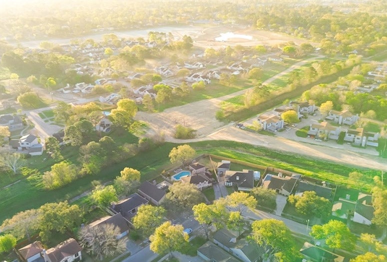

As a graduate student living in New Haven, Connecticut, Elizabeth Roberto said she couldn’t stop wondering why certain neighborhoods seemed connected while others were quietly walled off.
“There were these places where the roads just stopped,” Roberto recalled. “Like they were meant to go somewhere — but didn’t.”
It was the kind of everyday sight the average person might drive past without a second thought. But for Roberto, it sparked a question that would stay with her for years: What happens when barriers separate people — not just symbolically but literally?

Now a sociologist at Rice University, Roberto has turned that question into a pioneering research agenda. Backed by a $500,000 CAREER Award from the National Science Foundation, she’s investigating how features of the built environment — like dead-end streets, highways, fences and railroad tracks — shape patterns of neighborhood separation and access to opportunity across U.S. cities.
“It’s something I’ve been thinking about for years,” she said. “This award is incredibly exciting, and honestly, I’m still processing it. It’s the culmination of so many years of work.”
While many studies focus on economic factors, personal preferences or systemic discrimination in explaining residential segregation, Roberto’s research adds a physical layer to the analysis. Using satellite imagery, historical archives, redlining maps and artificial intelligence, she and her team are mapping how infrastructure decisions like where a street does or doesn’t go can reinforce racial and economic divides.
“You start to see these patterns repeating across the country,” Roberto said. “What I noticed in Connecticut wasn’t unique. Cities everywhere are shaped by the same forces.”
Her multiyear study will span 50 U.S. cities and introduce new ways to measure how spatial features of neighborhoods affect access to schools, transit and other public resources. That includes mapping not just what’s there but what’s missing.

At Rice, Roberto is building interdisciplinary learning opportunities in spatial analysis, urban inequality and data science for undergraduate and graduate students alike.
She also plans to develop an interactive, publicly accessible web platform to share her team’s findings with policymakers, researchers and community leaders.
“The NSF CAREER Award is one of the highest honors a faculty member can receive early in their career,” said Rachel Kimbro, dean of the School of Social Sciences. “This national recognition is a testament to Elizabeth’s premier research and dedication to the field of sociology. We are so proud of Elizabeth and grateful for her service as a School of Social Sciences faculty member.”
The roads we build — and the ones we don’t — tell a story. For Roberto, the work is about more than maps and measurements. It’s about making the invisible visible, helping cities, scholars and communities understand how decisions about streets, zoning and infrastructure shape the very fabric of opportunity.
“I’m not trying to say we should build more roads,” Roberto said. “But if we want to understand inequality, we need to see the ways physical infrastructure limits or enables access. This research is about creating tools that help us ask better questions about the way our cities are built and for whom.”